VI Region: Main cities
RANCAGUA
Located 87 km south of Santiago.
It is the capital of the VI region. It is a very important trade, agricultural and mining center. The city has the typical crisscross Spanish layout, formed by 8 by 8 blocks and a main square called Los Héroes. Its population is 179,638 inhabitants (Census of 1992) and the main economic activity is based on agriculture, industry and mining.
In the past the Picunches were the natives that lived in Rancagua and later, the Incas also used this land. The last of Picunches caciques –Tomás Guaglén- gave up part of the city for the future one which was founded in 1743 by the Governor José Manso de Velasco under the name of Santa Cruz de Triana.
In 1745 there were 40 houses and some installations to extract gold. Almost a century later the Battle of Rancagua took place, during which the patriots were able to resist for two days the powerful attack of the Ejército Realista, led by General Osorio. The batle caused the destruction of almost every building around the square.
The main attractions of the city are: Los Héroes square, the Regional Museum, the Casa de la Cultura, the Casa del Pilar de Esquina, The Iglesia de la Merced, Iglesia Catedral, Punta de Sol Shopping Center, Broadway Complex, and the Medialula that is the scenario for National Championship of Rodeo. Only 24 km south of Rancagua you can find the Club de Campo Coya.

SAN FERNANDO
Located 51 km south of Rancagua it is the capital of the Province of Colchagua and its population is 42,684 inhabitants (Census of 1992)
It is an important agricultural zone of the valley, and it has mechanic help and agricultural machinery.
Governor Manso de Velasco founded the city in 1742. It was called Villa de San Fernando de Tinguiririca and it was the first city founded in the central valley during the XVIII century.
In this city you can find important testimonies of colonial architecture and some great churches. The most amazing constructions are the Chapel and yards of San Juan de Dios Hospital (national monument), the Casa Patronal de Lircunlauta (national monument), Iglesia de San Francisco (national monument) and the Plaza de Armas in which interior there is a fountain acquired in 1870. Some kilometers to the east –next to Tinguiririca river- you can find Sierra de Bellavista resort, by La Misurina lagoon.
Mountain chain, mountains and hills
SIERRA DE BELLAVISTA
Located on the pre-mountain chain in the commune of San Fernando, 23 km southeast from Puente Negro. You can get there by ground road in regular shape, specially in winter.
This area is characterized by a pine forest that looks like a Swiss landscape during winter. There is a residential nucleus surrounding La Misurina lake.
This lake is surrounded by pine forests, an ideal frame to walks, horse rides and excursions. You can also find a place where you can stay at and get something to eat.
PUENTE NEGRO (Black Bridge)
Located 17 km. east of San Fernando, next to Claro river. The access is by paved road. This place with its excellent weather permits the access to Sierras de Bellavista, which is an option to make trips from San Fernando in daylight.
The place offers alternatives to the people who enjoy activities like picnic, hunting, fishing. It also has restaurants that provide a good service.
Folklore and typical things
DOÑIHUE
Located 25 km southwest of Rancagua.
Artisan center, well-known at a national level for its chamantos and its alcoholic drinks: a wide variety of chicha, chacolí and liquor.
The main characteristic of Doñihue is its craft, of a great national prestige, based on the making of the colorful blankets, chamantos and strips, knitted to loom with ancestral techniques. All of these are important parts of the attire worn by the huaso, Chilean typical character.
Most of the artisans dedicated to this difficult art are in the denominated Camarico area, located to the south of the urban nucleus.
Gastronomy
Among the typical dishes of this region we can mention: “porotos” or beans, “pancutras” (meat soup, vegetables and tiny, slight pieces of dough), fried pies or made in the oven. The turkey or pork casserole is also a traditional dish. So is the Chilean salad (tomato and onion), the tamales (milled maize wrapped in its own leaf), and maize pie.
Regarding drinks, the cacholí (made with tanned flour and orange juice), the grape chicha, the pihuelo (tanned flour and red wine), and the brandy from Doñihue are the most common in this place.
VI Region: Rapel Hydroelectric plant
Located 57 km south of Melipilla, it is one of the most important engineering works in Chile. It began its job in 1968. You can visit the installations on the outside everyday, since the road goes beside the plant. When snow is starting to melt, the water excess is evacuated through enormous toboggans. The main production of energy occurs in winter . The annual average production is 1 billion KW/h.
The structure is made of a dam wall which is a vault of concrete with a radius of 174 m and 350 m long on its top. Its altitude is 112 m. On top there is a public track that facilitates the communication between the provinces of Melipilla and Cardenal Caro. There is also a construction where you can find the machinery. Inside there are 5 turbines and their respective generators.
This hydroelectric plant has created one of the most visited artificial lakes of the central area, mostly because of the various bays. Its wind, water, weather and access have determined an excellent alternative to visit.
Lakes and lagoons
RAPEL LAKE
Artificial lake located 102 km west of Rancagua and formed by the water of rivers Tinguiririca and Cachapoal; it is a developing area which offers excellent equipment to practice water sports.
Its size is 8,000 hectares with a capacity of 720 million cubic meters of water and 40 m. long. It is the biggest artificial lake in the country.
Its shape is very peculiar: it has two wide arms; one of them corresponds to Cachapoal and Tinguiririca rivers; the other corresponds to Alhué and Las Palmas estuaries. The two arms get together, forming one wide new arm that advances 20 m before it gets to the dam.
At present there are only tracks that go round the coves and most of south and north coasts stil do not have access. Many tourists visit this place attracted by the climate, ladscapes, winds and the quietness of the water, which make a social center and the location of many sport events -windsurf, yatching, laser and water skiing. Regarding fishing, it is important to detach the pejerrey from Argentine.
Access:
Route 1: Santiago-Melipilla-El Manzano (Lago Rapel), 130 km paved road. Detour on Melipilla to the south. You have to take the cross Las Arañas to reach Longovilo central. This way you reach El Manzano. From Melipilla to E Manzano there are 62 km of paved road.
Route 2: Santiago-Melipilla-Central Rapel, Costa del Sol, 133 km paved road, 17 km of gravel.
Route 3: Rancagua-Doñihue-Coltauco-Peumo-Las Cabras-El Manzano (Lago Rapel), 96 km of paved road
Route 4: Rancagua-Pelequén-Peumo-Las Cabras-El Manzano (Lago Rapel), 102 km paved road.
VI Region: Historic places and monuments
CASA DE LA CULTURA (Culture House)
Located on 211th, 5 Norte, Rancagua. Old construction that was part of the Casas Patronales of the Fundo El Puente, belonging tothe Hacienda El Carmen and that later, on October 1st and 2nd, 1814, served as headquarters to the colonel of the Ejército Realista, Mariano Osorio. The house has been declared National Monument. Visits: Tuesday to Friday from 8:30 AM to 1 PM hrs. and from 3 Am to 6 PM hrs.
IGLESIA DE LA MERCED (La Merced Church)
Estado and Cuevas- Rancagua. Their construction dates back to the XVIII century and it is known by its important historical role in the Battle of Rancagua, place from where Bernardo O Higgins watched over from the tower, in vain expecting the help of José Miguel Carrera. Next to the church you can find the parochial house. Visits: Monday to Sunday.
CASA DEL PILAR DE LA ESQUINA (Del Pilar de la Esquina House)
682nd, Estado Street -Rancagua. This is an old colonial house with unknown date of construction. It is a two-story construction down Estado Street and of one floor toward Ibieta streetand. Inside part of the main patio still remains.
It has thick adobe walls, rafters, the roof is made of oak and over this there is an “encoliguado” that is tied in leather, to receive the mud of the tile, handmade cover. This structure corresponds to the original parts of the property.
GRANEROS
Town located 13 km. north of Rancagua. It is essencially an industrial and agricultural sector.
In the town stands out as attraction the Casa Hodgkinson, declared Historical Monument.
SAN JOSÉ DEL CARMEN MUSEUM – EL HUIQUE
This National Historical Monument constitutes one of the most valuable historical places in the country and it is located in the commune of The Palmilla, to 56 kms. of San Fernando (in route to Pichilemu).
The country property formerly located in the lands of Larmague, dates from the XVII century. During this period its proprietors were illustrious characters of Spanish origin, It was not until 1756 that the Coronel of the Reales, Pedro Gregorio Echeñique begins a true dynasty maintaining the property in the same family for almost 200 years.
His grandson Juan José Echeñique inherited the place and built in 1829 the house that still exists. The property is richly decorated with works of art and antiques, being important the following: the Church; the painting located in the room “doña Elena”; the bell of the church of the Compañía de Jesús, given by Pedro Subercaseaux to the President Errázuriz.
The outstanding characters that were important in that time help increase the historical value of the house. One of these is Mrs. Gertrudiz Echeñique, married to Federico Errázuriz Echaurren, president of Chile from 1896 to 1901. Their daughter, Mrs. Elena Errázuriz Echeñique, to the moment of its death requested to its children to preserve it. In 1975 they donated the property to the Army of Chile.
HOSPITAL-CHAPEL SAN JUAN DE DIOS
Negrete Street – San Fernando.
Construction declared National Monument that dates from 1848-1850 and which works remained temporarily unconcluded on lack of resources. In the year 1872, a group of eight nuns belonging to the Congregación de las Hijas de la Caridad arrives at San Fernando to organize the Hospital. In 1978, under Sister Julia’s custody the construction is enlarged, and in 1884 with funds donated by Mrs Mercedes Gómez the construction of the current chapel begins and was completely concluded in 1889. It is a brick building finely worked with the whole superior border and cornices forming a delicate filigram.
To visit the place, please ask for its keys in Hijas de la Caridad community, in front of the chapel.
CHURCH AND CLOISTER OF SAN FRANCISCO DE SAN FERNANDO
Located in front of Plazuela M. Rodríguez and Valdivia. This National Monument dates from 1744 when Jesuit missionaries built their house. In 1755 begins the construction of a new and larger church. Finally, in 1891 the old building is demolished and the construction of the current one begins. It is made up of three decks separated by two arcades that delimit the main deck, 8 m wide, more two lateral decks of 4 m wide that constitute the circulation spaces that finish off in altars and a tower of 32 m high.
CASA PATRONAL DE LIRCUNLAUTA (Colonial House)
Located in Juan Jiménez Street and Alameda, in San Fernando. Typical construction of colonial architecture, built in the XVIII century in the lands belonging to the Hacienda Lircunlauta. It belonged to Juan Jiménez de León who donated the 450 land blocks to found this city. The large house has a central place that contains a great yard surrounded by corridors and a backyard in “U” shape. It is Contiguous toward the north of the property the cellars and patios of works are located.
This National Monument is under reconstruction process to be soon transformed into a museum.
ROSS PARK IN PICHILEMU
Created at the end of the last century and restored in December, 1987, when being completed the 96th Anniversary of the commune. It has vast grasslands, small fountains with lights, standing out their centennial Fénix palm trees. Its recent restoration has transformed it into an attractive walk. It was declared National Monument in February, 1988.
SAN PEDRO DE ALCÁNTARA
Its main appeal is its architecture. This is the reason why it was declared Typical Zone. The Church highlights for their architectural style, complemented by the environment in which it is located, occupying lands originally given by Mrs. Francisca Muñoz de Gormáz to the Orden Franciscana in order to found a hospice at the end of 1600. In 1722 the foundation of the hospice is ratified. It was then, by order of Felipe V when a convent is erected that would give later origin to the formation from the village to its surroundings.The convent is concluded in 1725 and it is called San Pedro de Alcántara. The original work was damaged which leads to new constructions and restorations at the beginning of this century.
VI Region: Snow
CHAPA VERDE
Ski center located at 2,300 m over the sea level in lands of Codelco Chile, El Teniente division. You can only enter this center by buses specially designated for that purpose
In the shelter there are toilette facilities and a casino. It also has equipment renting, skiing lessons, patrols and first aid personnel.
It is open from May to September, depending on weather conditions. The center includes ski slopes for experts, semi-pro and beginners. The access to the slopes is by a dragging rail of 1,100 m long and a chair lift of 1,160 m long with the capacity to transport 700 people per hour.
VI Region: National parks
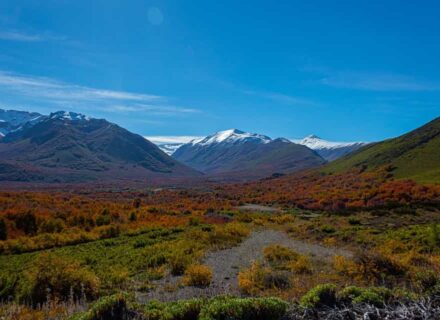
RÍO DE LOS CIPRESES NATIONAL RESERVATION
Conaf runs this national reservation. It represents the typical ecosystem of the Andes mesomorphic zone. You can find autochthonous species of flora and fauna.
The access to the reservation is by the Carretera del Cobre, President Eduardo Frei Montalva, until you reach Termas de Cauquenes hotel. From this place you have to continue for a 14-km road of ground that leads to the administration office of the reservation. This reservation has an audiovisual unit and a room of natural resources. It also has picnic and camping zones 6 km from the administration office.
VI Region: Pelequén
Small town located 35 km south of Rancagua. Every August 30th, thousands of people visit this place to celebrate the religious “party” of Santa Rosa in the church and sanctuary of Santa Rosa de Lima de Pelequén. From Panamericana road you can appreciate the dome made of copper. It is important to point out the typical pottery made in pink stone.
Another attraction of this town is the “Balneario Piedras de Gallo” by the Los Maquis estuary. People can make picnic and can also fish on the estuary. It is located 12 km from Pelequén.
VI Region: Beaches
PICHILEMU
Main coastal resort in the Region of O Higgins and capital of Cardenal Caro Province. It is 123 km south west of San Fernando and 182 km southwest of Rancagua by paved road.
Pichilemu offers the visitor many alternatives of recreational activities, in a rural atmosphere that conserves an aristocratic past, the one that goes back to the second half of the XIX century, when Agustín Ross Edwards conceived the creation of a resort of European style.
At present it is still possible to observe part of this interesting architecture:
– Ross Park: created at the end of the last century and restored in December 1987, when being completed the 96th Anniversary of the commune. It has vast grasslands, small fountains with lights, standing out their centennial Fénix palm trees. Its recent restoration has transformed it into an attractive walk. It was declared National Monument in February 1988.
– Casino Building: to the side of Ross Park. It is a three-story construction in which foreign materials were utilized. The work -that had begun in 1906- was finished three years later with the installation of the Mail Service and Telegraphs and a grocery s shop.
– Playa Pricipal or Terrazas: located in front of Ross Park; it has dressing rooms, showers service, bathrooms, parking for vehicles. It is apt for swimming; it also presents excellent conditions for the practice of surf. In the surroundings there are wide stoops with balustrades that date from beginnings of the resort and that go down Ross Park. There is also the mirador or terrace located on the rocks in the south end of the beach.
– Infiernillo: beach located to the south end of the city. The rocky formations where the waves break represent the main characteristic, being the attraction of the place.
– Playa Hermosa: long beach located in the road that leads to Punta de Lobos. It is apt for swimming and bank fishing.
– Punta de Lobos: beach located 6 km south of Pichilemu, by non-paved road. The cliff of approximately 100-m. high constitutes its main characteristic. So are the rocky formations that are frequented by sea wolves. The extension of its beach and the location make it apt to swim, to bank fishing, and it is also an ideal place for the practice of surfing.
BUCALEMU
Resort located 37 km south of Pichilemu. The access is by Cahuil, using a raft -property of the Dirección de Vialidad- that makes a 500-m transfer through Nilahue Estuary.
The beach has the shape of “U” with an extension of 1 km; it does not present incline and its swell is scarce, which makes it apt for swimming; it allows you to get in the sea without problems up to 80 m from the bank. The sand is fine and gray. To the south side, there is a picnic area.
In the same sector the creek of fishermen is located, where it is possible to have fish and shellfish, besides of practicing the fishing.
MATANZAS
Coastal resort located in the commune of Navidad, 5 km south of Lake Rapel outlet. Its long beaches of gray sand are apt for swimmers and fond of fishing.
In the surroundings of the commune, it is possible to visit other places:
– Las Vegas de Pupuya, resort of wide beaches, and currently it does not have tourist equipment.
– Las Brisas -small beach in horseshoe shape, of scarce swell and not too deep- offers alternatives to those who are fond of sport fishing;
– Finally you can visit La Boca de Rapel, located to the south side of Río Rapel outlet, 6 km north of Navidad.
VI Region: Rivers
Located 28 km south of Rancagua. The area near the mountain chain offers alternatives for people who enjoy being in the open air.
The areas of Popeta and Río Claro –located by Claro River at 7 and 8 km from Rengo respectively- have picnic zones and natural swimming pools that are open to the public in summer.
VI Region: Wine of Colchagua
Six wine-producing entrepreneurs of Colchagua Valley have united their efforts to develop a project called “Ruta del Vino del Valle de Aconcagua”, with the purpose of explaining the elaborating process of the wine. The program includes visits to wineries, wine tastings, visits to the Museum of Colchagua or “Casas del Huique”, lunch and transportation. All of this surrounded by a typically traditional environment and emphasizing the most typical aspects of the area, such as gastronomy, pottery and habits, everything accompanied by the nobility of the wine produced in Colchagua.
VI Region: Thermal baths
TERMAS DEL FLACO
Located 77 km east of San Fernando and at 1,720 m over the sea level. Thermals center that you can find on the pre-mountain chain area, by Tinguiririca River. Abundant flora and fauna, minerals and beautiful landscapes surround the place. The access is by non paved road which is open between December and April.
The temperature of the water varies between 160 and 200 Fahrenheit degrees. It has arsenic, chloride, sodium, calcium and other elements recommended for many illnesses.
The place has establishments to stay at and to eat, plus the alternative of natural pool baths and mud baths.
From the thermals it is possible to take trips to places such as Paso de las Damas, Laguna del Maule, and Lo Herrera. You can also appreciate the dinosaur footprints, considered national monument. Further information: tel (72) 711219, San Fernando.
TERMAS DE CAUQUENES
Thermal center located 31 km southeast of Rancagua and 760 m. over the sea level. Next to the southern bank of Cachapoal River, The terrain is very abrupt and wooded, covered with old trees –peumo, holm, pine and eucalyptus.
The access is by the Carretera del Cobre, President Eduardo Frei Montalva. Its existence dates back to before the arrival of the Spanish, when the natives used their “miraculous water”. The thermal water flows with a temperature of 115 Fahrenheit degrees and has chloro, magnesium, potassium, lithium, oxygen, bicarbonate, etc. These elements are advisable for skin and breathing problems, and reumathic and arthritic affections.
It is a comfortable thermal center with pool baths, beautiful natural surroundings, and rooms for conferences and seminaries.
Only 14 km. Away you can find the national reservation Los Cipreses.
CODEGUA
Old native settlement located 19 km north of Rancagua, with rich vegetation and great mountains.
The main attractions of the area are the Casa de Piedra, Palos Quemados, El Bolsón ravine, the graveyard, La Leonera cave, Las Marcas hot baths, Barahona dam, Inca Moli lagoon, Portezuelo, Codegua and La Punta estuaries, and La Leonera resort.
Tourism adventure
NATIONAL RESERVATION RÍO DE LOS CIPRESES
This National Reservation, run by Conaf, represents the typical ecosystem of the Andes mesomorphic area, where you can find autochthonous species of flora and fauna.
The access to the Reservation is carried out through the Carretera El Cobre, President Eduardo Frei Montalva, until arriving at the hotel Termas de Cauquenes. From this establishment, you have to continue by a ground track of 14 kms that leads to the administration of the Reservation, the one that has an audiovisual unit and a room of natural resources. There are picnic and camping zones 6 km from the Administration.
CHAPA VERDE
Ski center located at 2,300 m over the sea level in lands of Codelco Chile, El Teniente division. You can only enter this center by buses specially designated for that purpose
In the shelter there are toilette facilities and a casino. It also has equipment renting, skiing lessons, patrols and first aid personnel.
It is open from May to September, depending on weather conditions. The center includes ski slopes for experts, semi-pro and beginners. The access to the slopes is by a dragging rail of 1,100 m long and a chair lift of 1,160 m long with the capacity to transport 700 people per hour.
In this sector it is possible to practice snowboard.
SIERRAS DE BELLAVISTA
Located on the pre-mountain chain in the commune of San Fernando, 23 km southeast from Puente Negro. You can get there by ground road in regular shape, especially in winter.
This area is characterized by a pine forest that looks like a Swiss landscape during winter. There is a residential nucleus surrounding La Misurina Lagoon.
Pine forests surround this lake, an ideal frame to walks, horse rides and excursions. There is an establishment that offers lodging and feeding services.
TERMAS DEL FLACO
Located 77 km east of San Fernando and at 1,720 m over the sea level. Thermals center that you can find on the pre-mountain chain area, by Tinguiririca River. Abundant flora and fauna, minerals and beautiful landscapes surround the place. The access is by non paved road which is open between December and April.
The temperature of the water varies between 160 and 200 Fahrenheit degrees. It has arsenic, chloride, sodium, calcium and other elements recommended for many illnesses.
The place has establishments to stay at and to eat, plus the alternative of natural pool baths and mud baths.
From the thermals it is possible to take trips to places such as Paso de las Damas, Laguna del Maule, and Lo Herrera. You can also appreciate the dinosaur footprints, considered national monument.
VI Region: Rural tourism
A good definition for rural tourism would be: “group of tourism-related activities of reception and hospitality offered by the residents of rural areas”. This way it works as a complement for the traditional productive activity, generating new economic opportunities for the resident population.
Considering the economic basis of the population, the development of rural tourism in Chile is given in mining, agricultural, cattle-related, forest, fishing and service-related locations.
The places where these activities have developed are:
LOS LINGUES HACIENDA
It is located 126 km southeast of Santiago and 20 km northeast of San Fernando. This country property dates of the XVI century and the construction of its large house goes back at the end of the XVIII century and in their construction it was used adobe, lime and song, pink stone and noble wood.
The lodging services and feeding have been developed in a traditional architectural style, set with furniture, utensils and decorations of the time.
It is important to point out in the Lingues the Chapel, Medialuna, the hatchery of horses ” Aculeo “, the pool and also their Creole foods that synthesize the colonial features of our country.
SANTA CLARA
Located 160 kms south of Santiago -in the town of Zuñiga- in the agricultural heart of the Region of O Higgins, among Peumo, Guacarhue, San Vicente Tagua Tagua and Malloa.
The picturesque and old town of Zuñiga, with typical houses of adobe with tiles roofs and long corridors, is the entrance door toward the road that leads to the parcel of 8 hectares. These are surrounded by poplars and native trees. It is a place of country atmosphere, where it is possible to taste the Creole cuisine. The services it offers are: cavalcades, pool, walks by the surroundings, trips on the riverside of the Cachapoal, rides in bicycle, multiple courts, minigolf games, bowls or ping pong.
VI Region: Arecheology
SAN VICENTE DE TAGUA TAGUA
Located 52 km southeast from Rancagua. You can get there using the cross in Panamericana Road on the same latitude with Pelequén.
In this area there are traces of hunting, collecting settlements that prove its occupation more than 6,000 years ago. Another important finding is related to the bones of 8 mastodons, horses and American deers, with a date of 12,000 year approximately.
Other natural attractions near San Vicente is the Palmar de Cocalán, a forest of thousands of typical Chilean palm trees.
Its main attraction is the dry lake of San Vicente, which was the place where the first human settlement was found in Chile, 11,380 years ago.
DINOSAUR FOOTPRINTS
Located in the surroundings of Termas del Flaco, 77 km. east of San Fernando. The footprints were made about 120 million years ago and according to studies, they were supposedly made by these reptiles. The footprints were made in mud that after thousands of years became solid, burying them. After several million years -when the Andes was created- the petrified layer returned to the surface, which explains the strong slope of the land where the footprints are. They have been declared national monument.